Cape du Couedic is named after the French naval officer Charles Louis du Couedic, the Seigneur de Kergoualer (1740-1780).
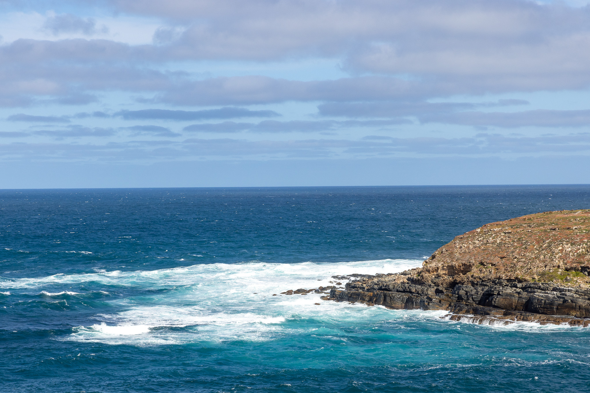
Because in the era of sailing ships, and even today, the Southern was a notoriously dangerous region for mariners.
Extreme weather and poor visibility limited accurate navigation and caused many shipwrecks.
So, that is the hint to you, dear reader that we saw a light house. This lighthouse has sent a distinctive warning flash that extends 40km out to sea to guide ships safely past the sharp, steep rocky cliffs.

Construction began in 1907 and was completed in 1909. It was built by teams of stonemasons who endured isolation, summer heat and winter storms to create this sturdy tower hewn from local stone.
The early lamps were fueled by oil, kerosene and then acetylene and needed three lightkeepers to maintain it around the clock.
Because I know you wanted a deep dive, the acetylene flasher was invented by Swedish Nobel Prize laureate Gustaf Dalen in 1906. Pure acetylene gas emerged from the upper burner jet holes and ignited a white flame, which in turn was focused by lenses into a beam of light. It was revolutionary at the time, but he did not stop there. Gustaf went on to invent a mixer. The mixer combined precise amounts of acetylene and oxygen which enhanced the luminosity of lighthouses. Which saved lives. It was also gas and dangerous stuff, so now good Gustaf has fallen to history and been replaced by solar power and efficient low-maintenance, safer LED lights. But that didn’t happen here until 1957, so Gustaf had a long run.
We believe, although no sign told us, the little structure on the right of the photo is where they kept the excess fuel. Don’t want that sitting in the basement of the lighthouse if it were to blow up. That would be bad.

The surrounding waters of Cape du Couedic are protected by the Southern Kangaroo Island Marine Park. Close to shore is the Cape du Couedic Sanctuary Zone where fishing is prohibited to protect an important breeding and feeding area for seals and sea lions.
But things are also protected on land. During the 2019-2020 bushfire event, the area of Cape du Couedic became an island refuge within a sea of destruction. This small patch was one of the few areas to escape unscathed, so wildlife fled the flames and took refuge here until the fires were extinguished.
I did not come here to look at a lighthouse. We did that, but the main reason to be on this part of the island for me was a natural feature called Admirals Arch.
Just beyond the lighthouse, down a long ramp and several stairs, among the pounding waves and a lot of fur seals, you see this…

Admirals arch has been shaped by the constant pounding of waved from the Southern Ocean over millions of years.
Once part of the supercontinent Gondwana, Australia was shaped by the movement of plates across the planet, causing volcanic eruptions and the upthrust of mountains.
Between 60 and 45 million years ago, Australia separated from Antarctica, causing all kinds of problems for their kids in the divorce. But continents will do what continents will do. So, leaving Antarctica and their cold shoulder behind, Australia drifted north to warmer seas.
Except there was an ice age, so the cold followed. Glaciers carved and polished the landscape, then eventually melted. Sea levels rose and Kangaroo Island was cut off from the mainland.
But that did not stop mom nature from doing her thing. Ongoing weathering, erosion, and sedimentation created unique rock formations, cliffs, dunes, and caves. Including Admirals Arch which is now recognized and protected as geological heritage site.
Knowing nothing of this place other than it was a great photo op (at the right time of day/year/alignment of the stars), and a powerful expression of what Mom nature can do, I ventured toward the edge of the cliff.
And found a handy accessible ramp to follow. Thank god. I did not want to get out the ropes and harness and hang over the edge today.

Ramp or otherwise, it was a harrowing journey because of the wind.
I think I mentioned it was windy where we are staying. This… was also windy. Very windy.
Yet entirely dangerously beautiful. As long as you stayed on the ramp, hunkered down and held on for dear life, the crashing waves were loud and majestic. And make no mistake, they were huge waves, crashing constantly against the rocks emphasizing repeatedly the death trap they are… but they were also loud and majestic.

“Hardy sea creatures endure crashing waves in the intertidal zone and coastal birds next and forage along the remote shores.”
Or so notes the sign. I saw fur seals and a few seagulls.
Apparently under the water, there is a lot more going on. Duh.
The Great Southern Reef stretches over 8,100km from the Pacific to the Indian Ocean, and a lot of that reef shapes Southern Kangaroo Island. A lot of kelp forests, seagrasses and sea creatures, including the Western blue groper (Achoerodus gouldii) inhabit the area. The Blue groper can live up to 70 years, and is apparently key to keeping crabs and sea-urchin populations in check. They also can transform from female to male during their life cycles. Probably when they are tired of having kids.
The sheltered beaches of the island… I would not classify this as a ‘sheltered beach’ but there must be one in the area because that is where sea lions and seals breed. And there were a lot of seals hanging around the rocks.

A sign tells me these are long nosed fur seals in their natural habitat. The sign also noted strong winds may be experienced, so I am confident the sign does not lie. Strong winds were experienced. And it was an experience you cannot reproduce in a photo.

Of course I tried, but just to clarify again… it was windy.

And the fur seals, either on the rocks or in the water, did not appear to mind.


Admirals Arch was more impressive along the path you travel to get to it. You cannot see it until the last turn on the stairs and it sits in a relatively protected cove for your viewing pleasure.
It also is not accessible to walk the stones or under the arch, or… again, stay on the path. Anywhere beyond the path is the path of seals or fools in my opinion. Yet a small part of me would have liked to have a different angle of view on the whole thing.

The unexpected surprise for me was the seals, and the fact they gave me an excuse to stop on the way back up the steps to take a few pictures. And to hold on until the wind died down, which it did not. But we made it back to the car in tact and moved on.